Project Description:
City Layers – a transdisciplinary city-mapping framework – centres on citizen experience of urban space as an integrative way to increase urban livability. Its purpose is to reveal, map, and inform citizens’ spatial needs, while also helping fulfil them. As digital transformation and AI-driven approaches increasingly drive social change, City Layers addresses the challenge of integrating human perceptions and lived experiences within urban planning. The project comprises:
1.A series of “mapping walks” through which the research team and citizen scientists identify, record, and reflect upon the spatial challenges they face;
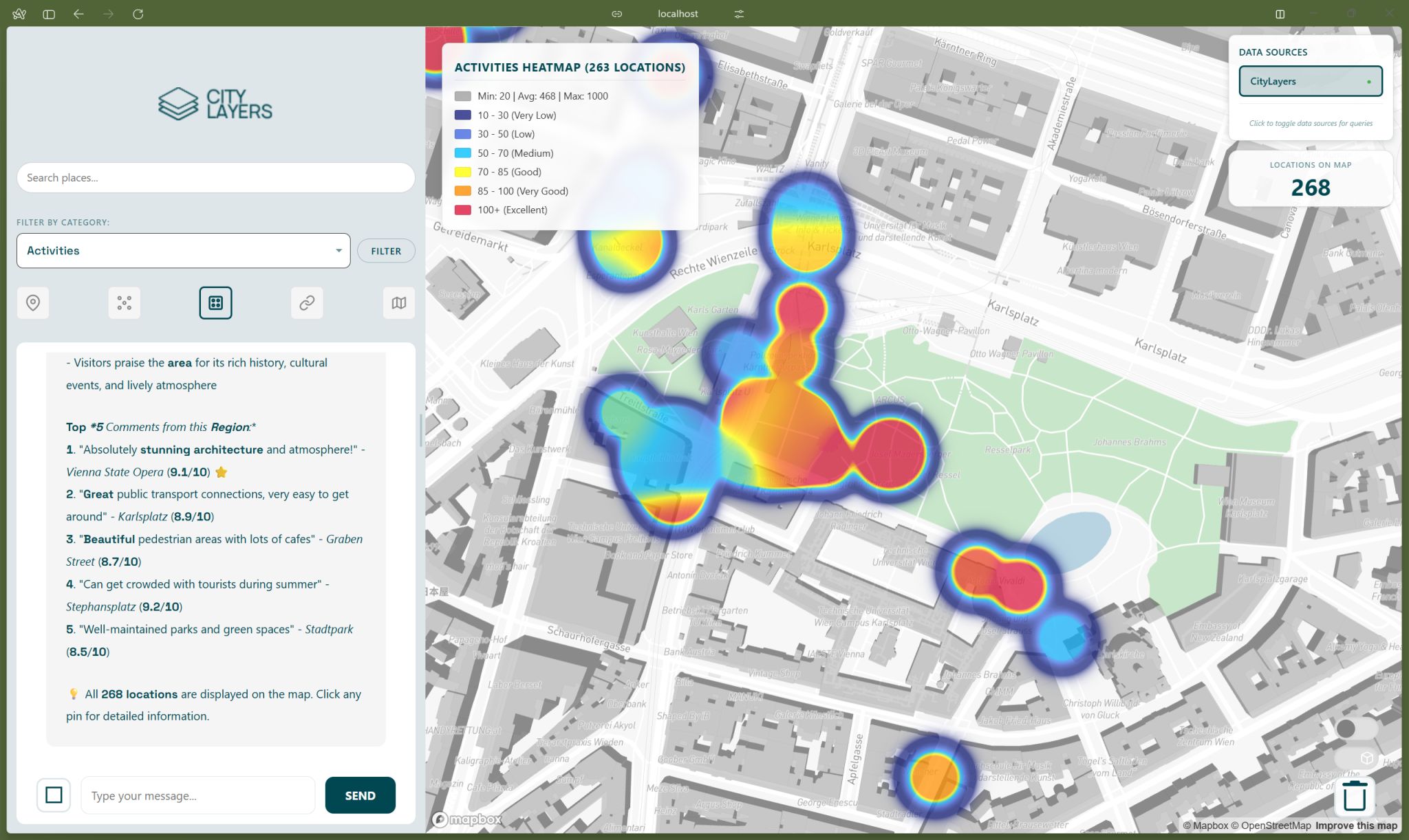
2.The Spatial Intelligence Dashboard that transforms individual spatial observations into actionable knowledge, shared with citizens and decisionmakers.
Based on a scientific approach, our co-created dashboard translates complex urban challenges into concrete, site-sensitive indicators – “layers” of urban space that citizens identify, map, and visualise. By reorganising individual spatial observations into collective knowledge, the City Layers framework provides essential urban information and a citizen-centred roadmap for improvement. Open to both citizens and city planners, City Layers fosters a more equitable approach to urban development – based on collective intelligence.
Project Type: Sustaining
Theme: Inclusion
Mentor:Patricia Tiago

City Layers: A Collaborative Framework for Resilient City-Making
City Layers is a citizen science framework that maps people’s subjective urban experiences and translates valuable community contributions into robust spatial data. This approach is essential for urban planning and governance, as it fills critical gaps in urban data by directly incorporating knowledge generated by residents. By doing so, City Layers enables more informed decision-making and supports the creation of responsive urban environments.
The core team includes Lovro Končar-Gamulin (Project Lead), Androniki Pappa (Research and Participation Lead), Domagoj Krhen (Product Lead), Angelos Chronis (Tech Lead), and Stasja Fedorova (Technical Implementation). Our citizen scientists include two core under-represented groups: minors and people with functional diversity.

The project addresses a critical challenge in urban planning: integrating subjective, lived human perceptions and experiences into data-driven decision-making. As part of IMPETUS Challenge 2, Citizen Science for a Fair and Just Society, City Layers aims to increase city livability by bridging the knowledge gap between planners and diverse communities. It fosters an inclusive approach to urban transformation, with a particular focus on empowering groups whose spatial needs, such as noise exposure, safety, climate comfort, or mobility, are often overlooked.
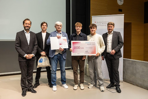
Working primarily in Vienna, Austria, we transform subjective knowledge into layers of collective intelligence through a dedicated web app and analogue mapping kits. Our methodology involves citizen scientists mapping and assessing urban characteristics, such as climate comfort and safety, and visualising the results on our Spatial Intelligence Dashboard. Key activities included structured mapping sessions to test and validate the City Layers pilot, which was officially launched with our participation in the Citizen Science Award 2025. This effort engaged more than 500 citizen scientists and collected over 2,000 individual data points. The same pilot also supported Marcus Kautz’s master’s thesis, significantly expanding the project’s academic impact.
The IMPETUS Accelerator provided vital funding and strategic validation for our work plan and ethical considerations, enabling the successful implementation of our core activities. The support and visibility offered by the IMPETUS network helped elevate City Layers within the field of science engagement. This was reflected in our selection as a Global Finalist for the Falling Walls Science Breakthrough of the Year 2025.
We also gained valuable experience in communicating our methodology to high-level international stakeholders, including presenting the framework as experts at the AIFOD Summit at the United Nations Office in Vienna and at Placemaking Europe Week 2025 in Reggio Emilia, Italy.
Our current focus is on refining the platform and methodology to support planning and policy integration. We are working to strengthen collaborations and develop new project proposals that will enable City Layers to inform concrete spatial and policy interventions. In parallel, we are enhancing the Spatial Intelligence Dashboard with new features that support more meaningful participation and more advanced analytics, including the integration of subjective citizen data with at least ten existing open datasets.