Project Description:
In this project, we will introduce newly arrived youths from Ukraine temporarily residing in refugee facilities in Twente (The Netherlands) to citizen science by engaging them in the active exploration and mapping of informal places for sports and recreation.
Project Type: Kick Starter
Theme: Cities for Life, Mobility
Mentor: Louise Francis
Mapping for recreation: a place-based citizen science project with refugee youth.
In the “Mapping for Recreation” project led by the Faculty of Geo-Information Science and Earth Observation at the University of Twente, refugee youths from Ukraine mapped places for play and sports in six cities in Twente, a region in the Netherlands. 74 participants aged 8-14 worked in teams to explore places ranging from national parks to urban playgrounds and provided their perspectives on the enablers and barriers to outdoor recreation in their new home environments.
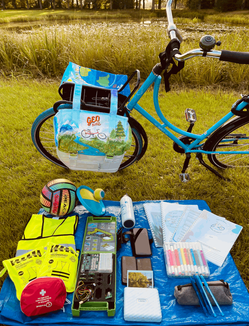
During the summer break, the teams went on bicycle field trips, accompanied by adult volunteers. The “GeoBike” was equipped with research journals to reflect on the attractiveness of visited places, sensors to measure temperature and humidity (playing is not fun if you are on an urban heat island!), mobile phones with the Epicollect app to record observations and take pictures, play equipment, and even a mobile photo printer to capture the most memorable experiences. Each team conducted 20 to 25 hours of fieldwork, collectively mapping 101 places.
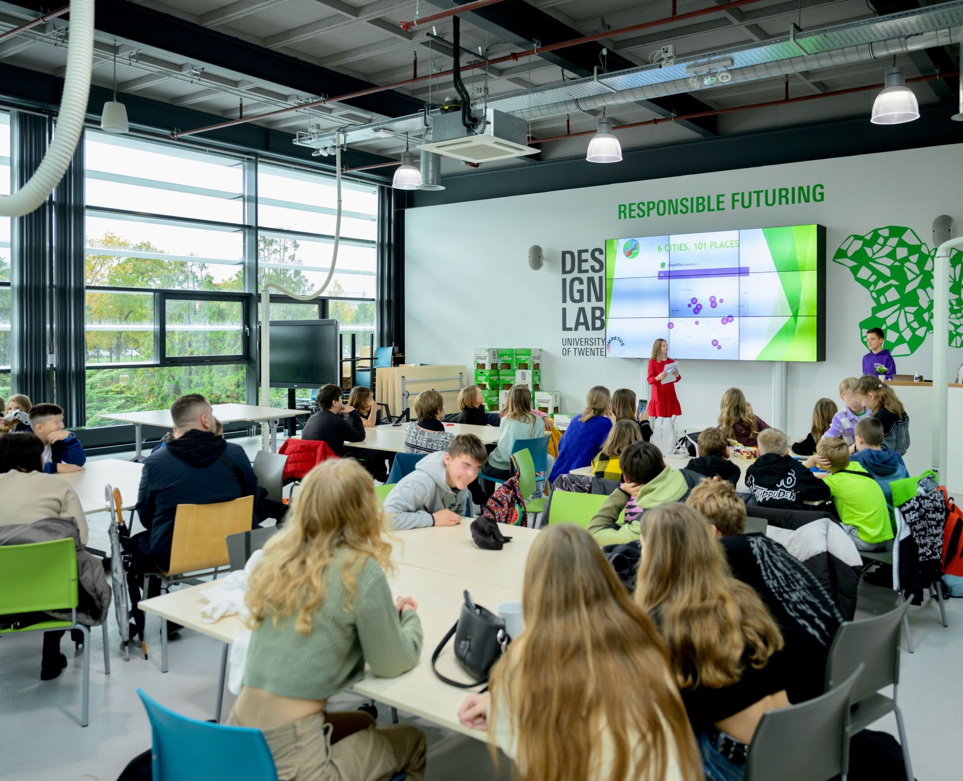
Beyond data collection, participants were introduced to the scientific process and the concept of a 15-minute city, and learnt sensor programming, data export, and map-making. They also employed design thinking to craft inclusive and sustainable recreational spaces, learning to treat nature as a stakeholder, and using LEGO for creative prototyping. The project’s closing event, led by the participants themselves, showcased their findings, prototypes, and artistic installations reflecting their experiences. The youths were excited to give interviews to be featured in a local newspaper and the University of Twente’s GeoHero YouTube channel.
Map4Rec was more than just exploring new places; it provided an opportunity for these young researchers to forge friendships, acquire new skills, and contribute to the community by creating a map that can be used for inspiration by newly arriving and local youths. It also fostered a local community committed to children’s rights, including their right to the city. The project’s success was owed not only to the dedicated team and project friends but also to the invaluable support of IMPETUS. Their guidance in navigating the diverse terrain of citizen science, comprehensive training, and tailored mentorship greatly contributed to the project’s impact and sustainability.
Currently, the project team is summarizing the findings for scientific publications and policy reports. Our goal is to inform local municipalities and UNICEF Nederland on enablers and barriers for outdoor recreation among refugee youth and to advocate for the adoption of citizen science for engaging youths in urban planning. In the next step, we will co-design – jointly with youths – a multilingual map-based platform that will allow them to further share their experiences and suggestions in relation to places for recreation. We also aim to expand our community by co-creating an actionable roadmap towards inclusive citizen science with youths. Our activities are shaped by the vision of citizen science that contributes to place bonding and well-being, increases societal cohesions and resilience, and nurtures the generation of active and critically thinking youths keen to address contemporary challenges.
Mapping for Recreation – Video